Geolocating a Missile Strike
By Rhett
Published on May 20, 2025
Tags: #GEOINT #Israel #Houthi #Geolocation #Conflict
I have begun trawling through X to try and find opportunities to learn and practice geolocation and chronolocation of events.
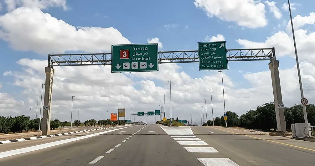
Recently, I came across a tweet (an X?) which linked to this BBC article from May 5, 2025, describing a missile strike near to Israel's Ben Gurion Airport with the accompanying image.
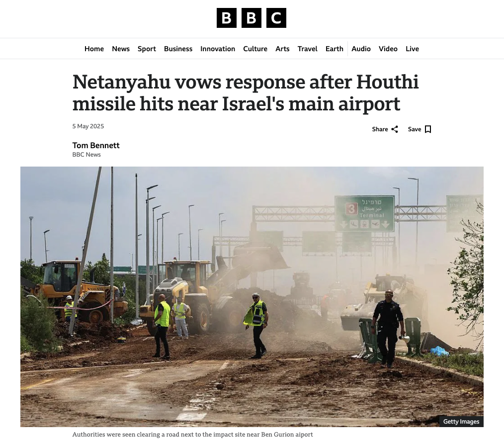
Source: BBC/Getty Images
I decided to see whether I could geolocate the exact location of the strike and find supporting evidence that a strike hit the area around that date.
Investigation Stages
- Find the strike site using Google Maps
- Confirm strike site using Copernicus satellite imagery
Tools Used
 Google Search
 Google Maps
 Google Maps Streetview
 Copernicus Browser
Sources Used
 BBC
BBC
- Google Maps
- Google Maps Streetview
 YouTube
- Copernicus Browser
Stage 1: Find the strike site using Google Maps
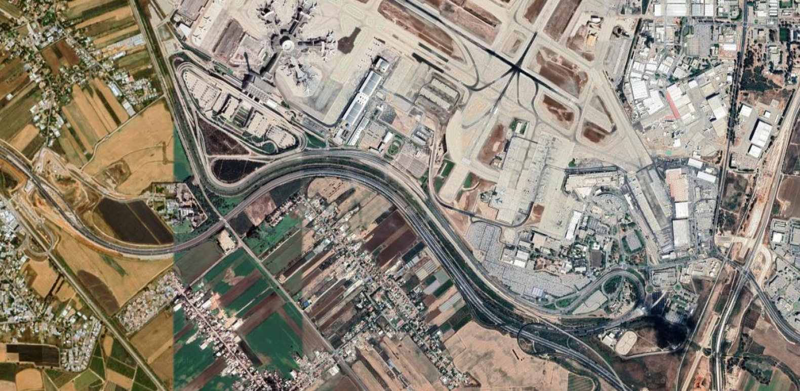
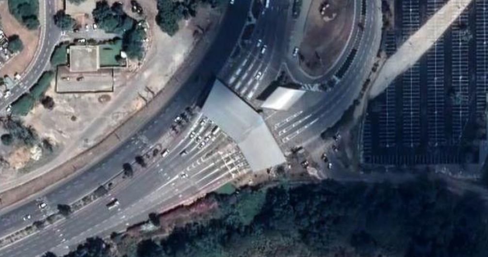
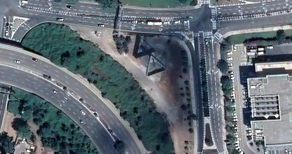
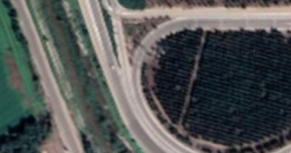
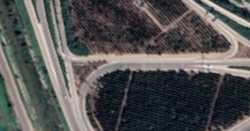
Source: Google Maps
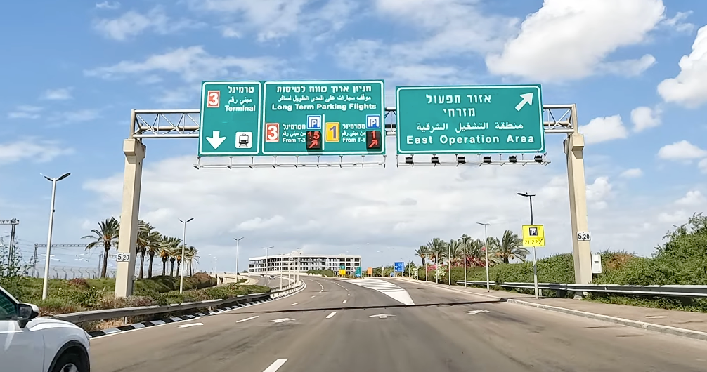
To begin, I used google maps to look for the location of Ben Gurion airport and Terminal 3.
From a brief look at the map of the airport and the surrounding area, the primary road leading into the airport comes via the Ben Gurion Interchange. Unfortunately, streetview wasn't available for any of the approach roads to the airport (potentially for security reasons).
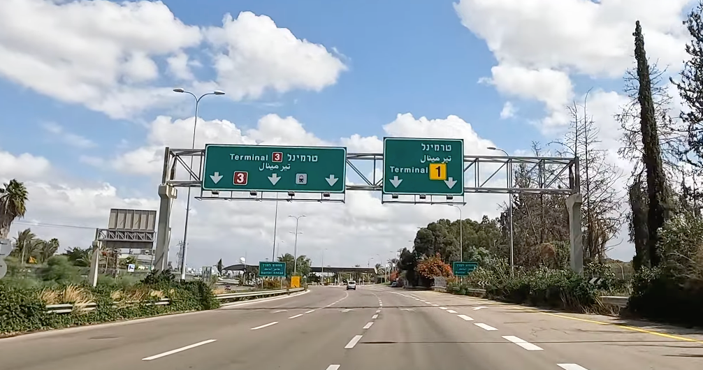
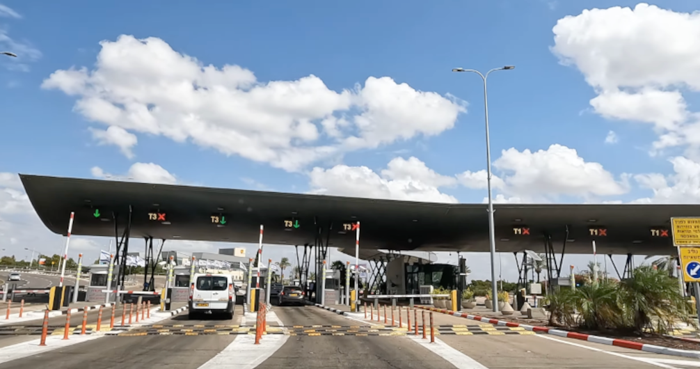
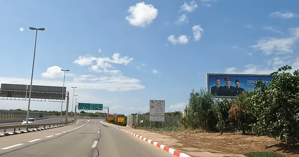
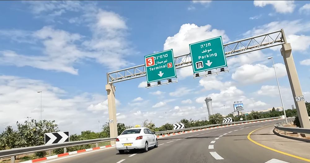
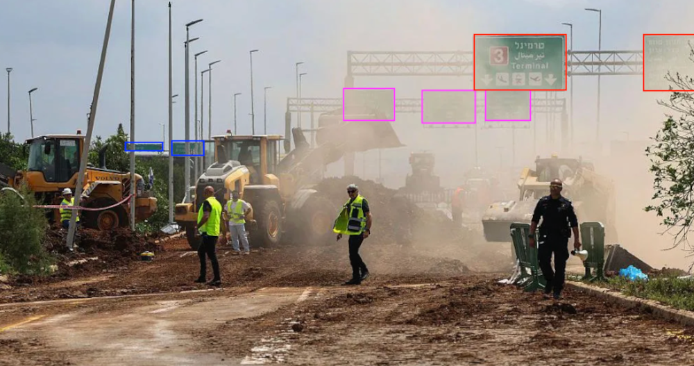
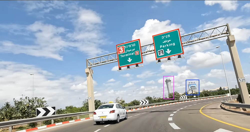
By searching for guides on how to get to Ben Gurion Airport by car, I did manage to find a video on YouTube which drove the length of the journey from the interchange to the terminal and so I cross-referenced the footage with Google Maps to indentify the impact site of the missile.
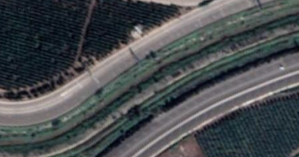
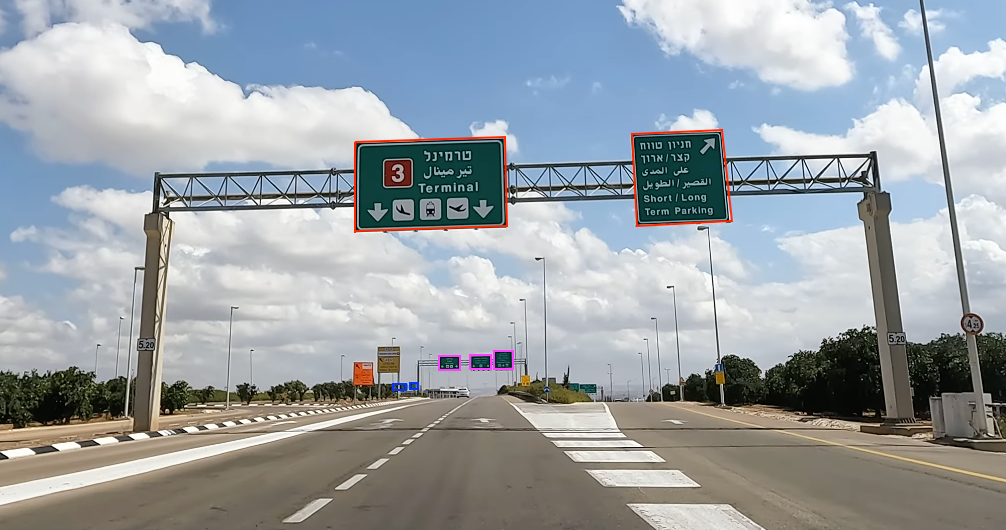
Each photo below shows a section of the approach road from satellite and street view. Hovering over each image highlights its position on the map.

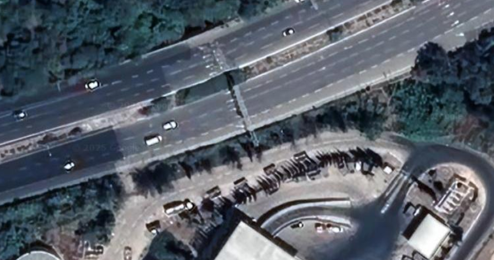
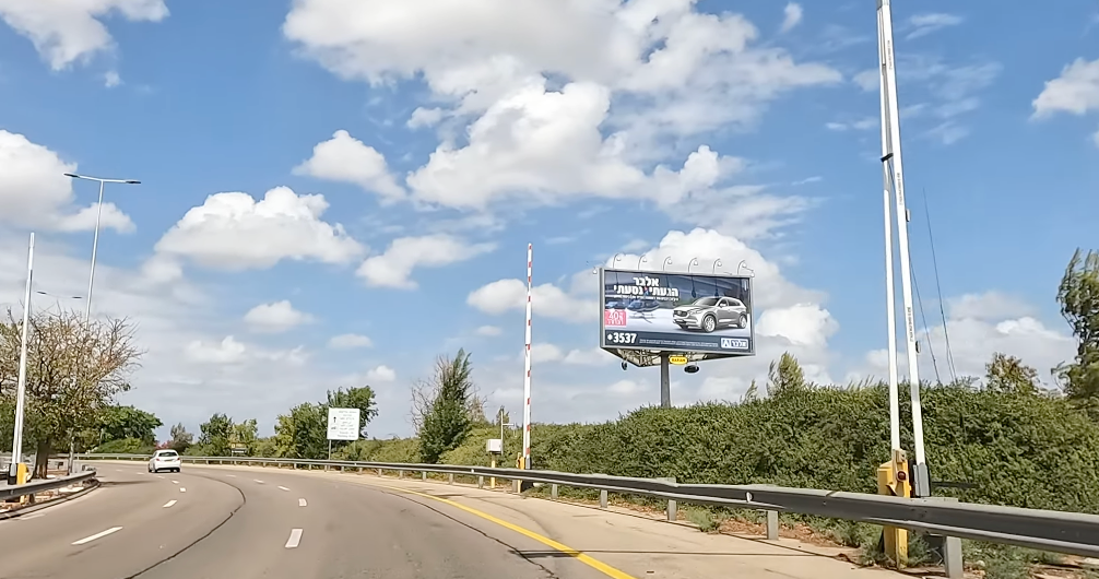
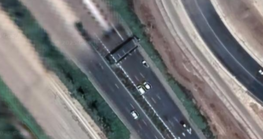
Source: Google Maps/My Little Israel (YouTube)
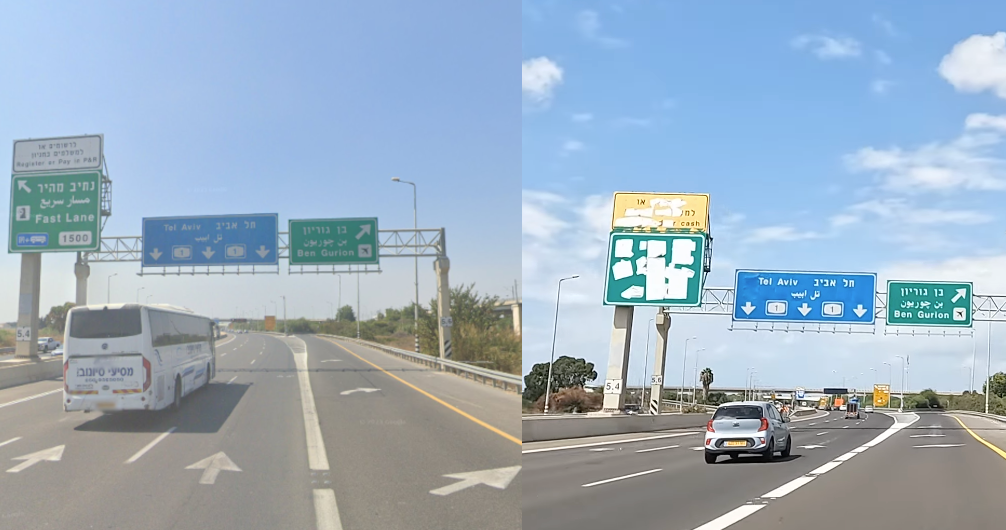
Comparing the BBC article image and YouTube footage
The placement of road signs are similar to the ones from the BBC article and the Terminal 3 sign an exact match. You can see a side-by-side comparison below.
Source: BBC/My Little Israel (YouTube)
An article from the Times of Israel also pictured debris across a section of road located immediately prior to the identified missile site. A comparison of the YouTube footage and the article's image is shown below.
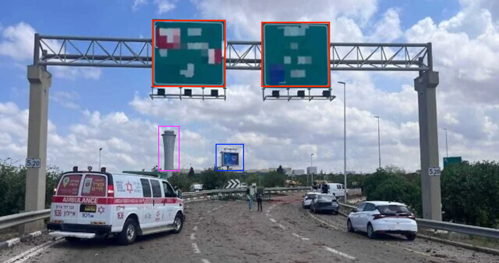
Source: Times of Israel/My Little Israel (YouTube)
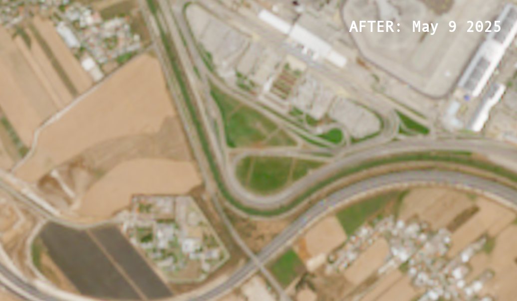
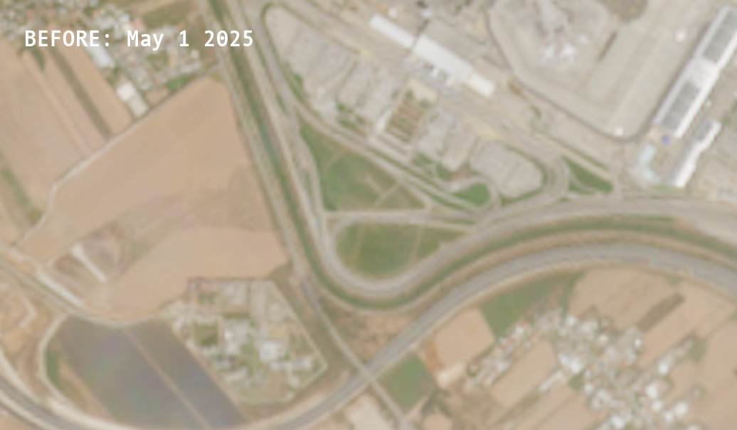
Stage 2: Confirm strike site using Copernicus satellite imagery
Below is an interactive comparison of satellite images from the Copernicus Browser platform. It shows the changes from May 1 to May 9 2025. The BBC report was published on May 5 2025, thus showing us before and after.
Using the Toggle Color button switches between true and false colouring which more clearly identifies the bare earth from the missile impact.
The coordinates of the missile strike from these images are 31°59'48.7"N 34°52'06.5"E (///opposite.best.riot)
Source: Copernicus